

 eTyphoonImg
The probabilities of issuing severe weather warning signals
Update Time: 2021-07-06 23:00
| Signals | Forecast Period | Probability |
| Typhoon Signal No.1 | In effect | |
| Typhoon Signal No.3 | Early morning on 7th | Relatively low |
| "blue" Storm Surge Warning | Low | |
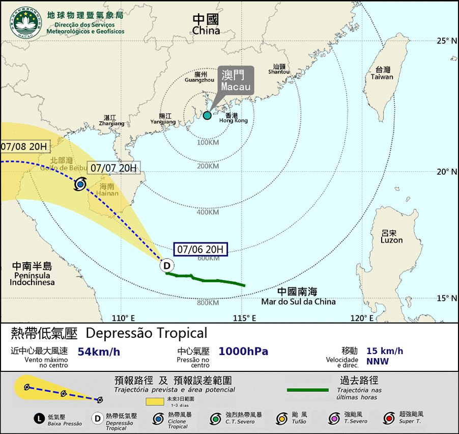
The tropical depression over the central part of the South China Sea is expected to move in the northwest direction, towards Hainan Island. As the tropical depression is at a distance far away from Macao, the possibility of issuing higher tropical cyclone signals remains low in the early morning tomorrow(7th). As it is not in the high phase of the astronomical tide, the possibility of storm surge will be low.
Affecting by the outer rainbands of the tropical depression, there will be showers, heavy at times, and strong gusts on the 7th. The public is advised to pay attention to the latest meteorological information before going out.
Remarks: The probabilities of issuing severe weather warning signals for the next one or two days are provided in the table. Public can learn the possibility of being affected by the tropical cyclone over the specific period of time in Macao so that necessary precautions can be well prepared earlier. Please keep notice of our latest information.