

 eTyphoonImg
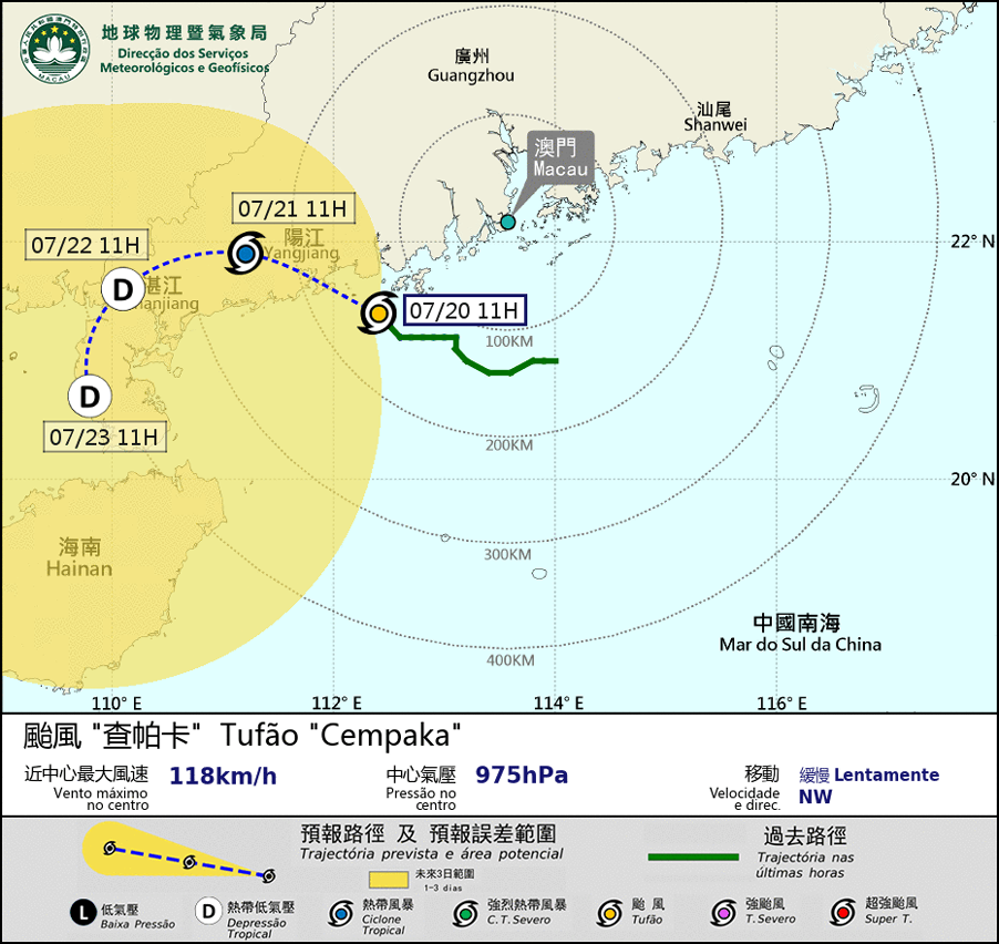
Possible warning signals to be issued due to the impact on "Cempaka"
Update Time: 2021-07-20 11:00
| Signals | Forecast Period | Probability |
| Typhoon Signal No.3 | In effect | |
| Typhoon Signal No.8 | Low | |
Typhoon " Cempaka " slowly moved towards the coast of Yangjiang. Since the circulation remains small and maintains a distance of more than 150 kilometers from Macao. The possibility of issuing higher signal is low. Under the influence of its outer rainbands, there will be occasional strong winds and heavy showers in Macao during the daytime. The public is advised to pay attention to the possibility of flooding caused by the heavy showers.
As " Cempaka " will still linger on the west coast of Guangdong in the next two or three days, the track of " Cempaka " is still uncertain, the public is advised to stay alert and pay attention to the latest storm news.
Remarks: The probabilities of issuing severe weather warning signals for the next one or two days are provided in the table. Public can learn the possibility of being affected by the tropical cyclone over the specific period of time in Macao so that necessary precautions can be well prepared earlier. Please keep notice of our latest information.