

 eTyphoonImg
The probabilities of issuing severe weather warning signals
Update Time: 2021-07-06 11:00
| Signals | Forecast Period | Probability |
| Typhoon Signal No.1 | In effect | |
| Typhoon Signal No.3 | Daytime on 6th July | Relatively low |
| "blue" Storm Surge Warning | Low | |
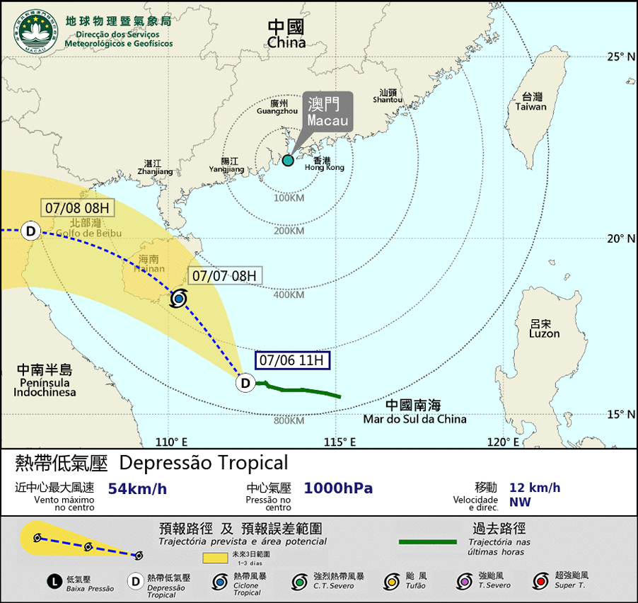
The tropical depression located near Taiwan, is expected to move towards the direction of eastern Guangdong in the evening . As the circulation of the tropical depression is small and the intensity will be weakened gradually, it is expected to have no significant impact to Macao. Meanwhile, the tropical depression over the central part of the South China Sea will move towards Hainan Island in the next 2 days. The weather in Macao is expected to turn cloudy later on today, with more frequent showers and increasing windspeed followed in the next 2 days. On the other hand, it is not in the high phase of the astronomical tide, thus the possibility of storm surge will be low. The public is advised to pay attention to the latest meteorological information.
Remarks: The probabilities of issuing severe weather warning signals for the next one or two days are provided in the table. Public can learn the possibility of being affected by the tropical cyclone over the specific period of time in Macao so that necessary precautions can be well prepared earlier. Please keep notice of our latest information.